
About Us
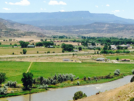 De Beque, Colorado is a community of about 550 residents nestled in the foothills of the Roan Plateau of the Book Cliff Range. The Colorado River flows through the Town and provides irrigation for bountiful agriculture and cattle production. The area enjoys a four-season climate with summer highs in the 90‚ and winter lows dipping below zero. The community has enjoyed a deep and rich history even before its founding in 1884. Cattle ranching was the primary industry for decades until the 1920‚ when energy resource production rose to prominence. Today, the economy of the area derives its strength from energy production, recreation/tourism, and agriculture. The children of the region are educated at a best in the class K-12 campus which is in the process of undergoing a major capital construction renovation to prepare for the next 40 years.